A hidegháború | Bevezetés
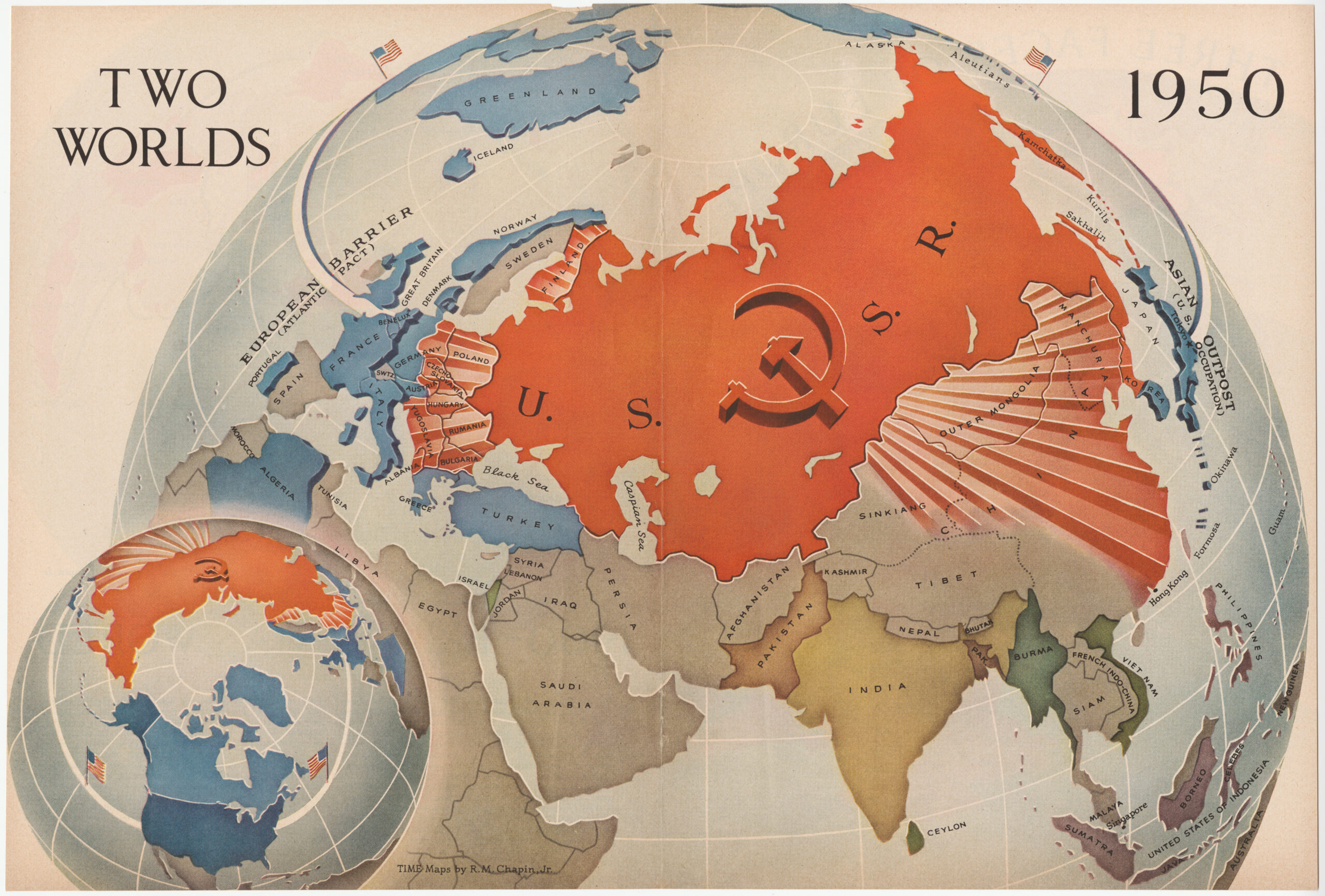
"Two Worlds" map by Robert M. Chapin published in Time Magazine, January 1950.
A typical map of many of the anti-communist maps that appeared in all American news journals by 1950. These maps used a north polar projection because seeing the northern latitudes from this perspective emphasized the dangerous closeness of the Soviet Union and the United States over the Arctic Circle.
A typical map of many of the anti-communist maps that appeared in all American news journals by 1950. These maps used a north polar projection because seeing the northern latitudes from this perspective emphasized the dangerous closeness of the Soviet Union and the United States over the Arctic Circle.